CURACAUTIN, CHILE
Curacautín is a commune in Chile, located in the Araucanía Region, in the Malleco Province, close to the Tolhuaca, Lonquimay and Llaima volcanoes, all seen from the city. Curacautín is the gateway to the macro zone of the Andean Araucanía and the Chile-Argentina Bioceanic corridor.
Rethinking The Future Awards 2023
First Award | Urban Design (Built)
| Project Details | |
| Project Name: | Parque Manuel Rodriguez, Curacautin |
| Category: | Urban Design (Built) |
| Studio Name: | Jaime Alarcón Fuentes / Impulso Arquitectos |
| Design Team: | Jaime Alarcón Fuentes , Mauro Devaud, Erika Saldaña, Víctor Sanhueza, María Luz Pérez, Patricia Herrera |
| Area: | 21.000 M2 |
| Year: | 2022 |
| Location: | Curacautín , Araucania region, Chile |
| Consultants: | Curacautín Municipality , Chile |
| Photography Credits: | Ignacia Astaburuaga |
| Render Credits: | Mitchel Contreras |
| Other Credits: | Construction Landscaping: Karin Topp |
| construction company: FCB, Francisco Javier Cofré E. | |
| Owner: Municipalidad de Curacautín | |
| Financing: Gore Araucanía | |
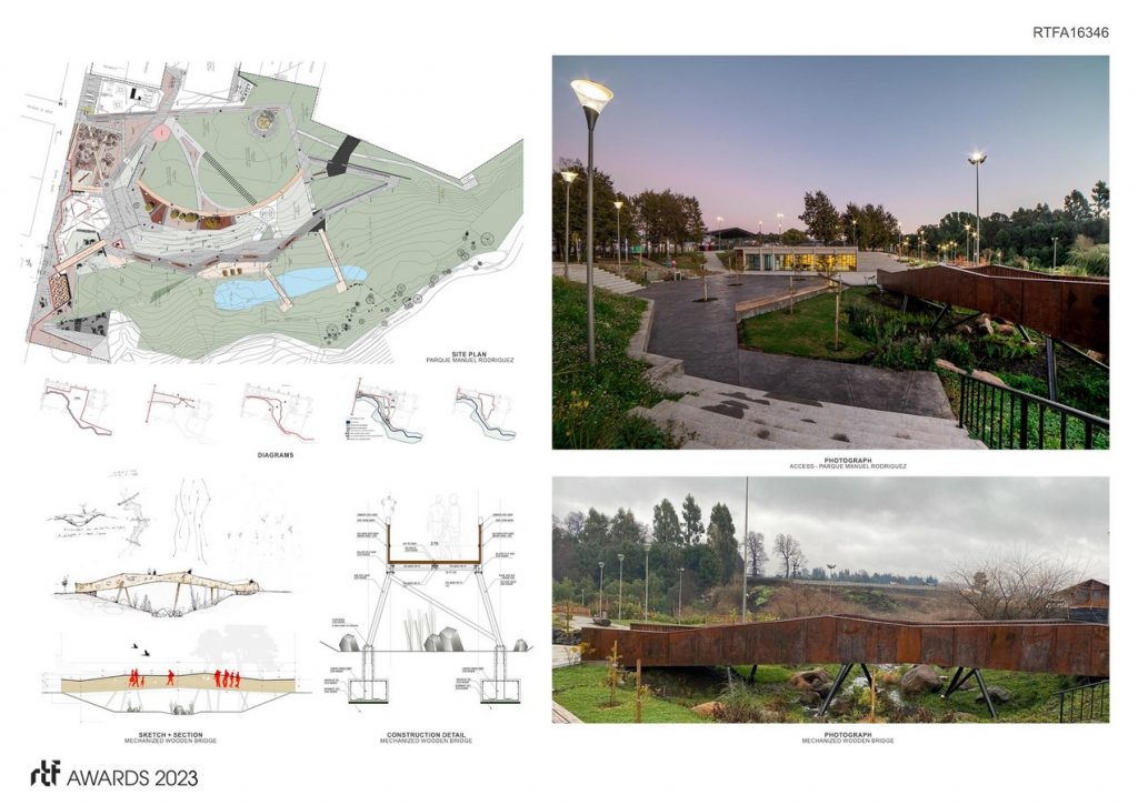
©Ignacia Astaburuaga
LOCATION AND CONTEXT
Within the framework of the MINVU small towns program, a master plan has been developed that promotes Curacautín as an articulating pole of tourism, a leading city of services for the traveler who ventures into its variety of mountain landscapes, national parks, lagoons and baths.
But on the other hand, it promotes the development and well-being of the inhabitants of the town, where the plan takes charge of the expansion zone of the city and the scarcity of consolidated public spaces and meeting areas of the inhabitant.
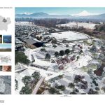
On one of the edges of the Manuel Rodríguez neighborhood, there is a 3-hectare plot. Acquired by the municipality for an urban park that, due to its morphological conditions, is redefined in an approximate area of 2ha. It is proposed to consolidate a disused edge in the commune, previously used as a wood sawmill, which is currently a garbage dump.
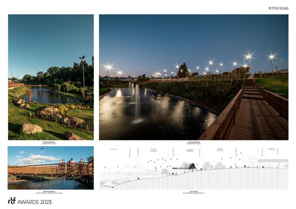
©Ignacia Astaburuaga
THE PARK
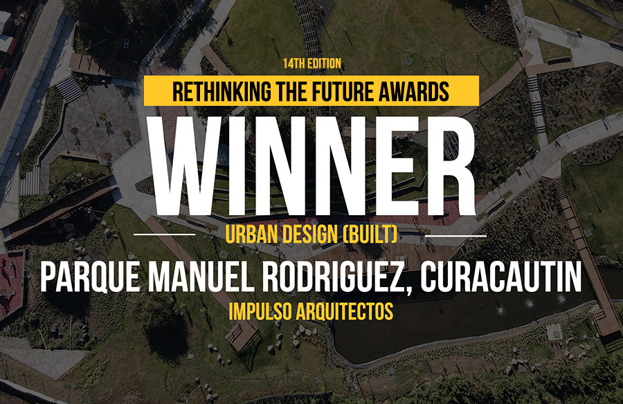
The architectural project proposes a public park on a neighborhood scale where the morphology of the land gave the first clue to the way of inhabiting the park. In the first instance, a central mound is recognized
or urban hill detached from the neighborhood, which falls with slightly pronounced slopes that were shaped by the runoff of rainwater and snow until it fell into the adjacent watercourse.
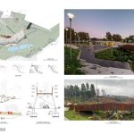
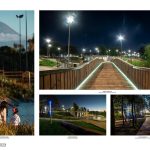
An accessible ring is proposed as the main circulation of the park, which surrounds the edge of the urban hill as an ordering axis that allows to travel the entire park with accesses that cross the low areas passing over the wild areas as bridges that refer to the trunks fallen from the forests of the Araucanian territory.
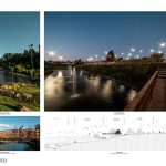
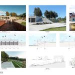
On the other hand, a greater intervention towards the neighborhood is defined, consolidating the urban edge of the park with the built-up fabric of the neighborhood, and towards its other edge specific interventions that value the local natural landscape and its distant mountain context, connecting its borders by means of bridges, sidewalks and footbridges that cross the small forest of Raulies and do not modify its topography in general terms, allowing the water to maintain its surface runoff courses, forming terraced areas until reaching the landscape terrace which proposes to collect the rainwater in a pond generating a sustainable irrigation system that optimizes rainwater generating a natural ecosystem that in landscape terms optimizes water resources through the selection of vegetation and endemic species according to the climate of the area and low water consumption accompanied of volcanic rocks and wooden terraces that refer to a mountain landscape and its history that in built terms recognizes a material identity of the city linked to its logging and railway past.
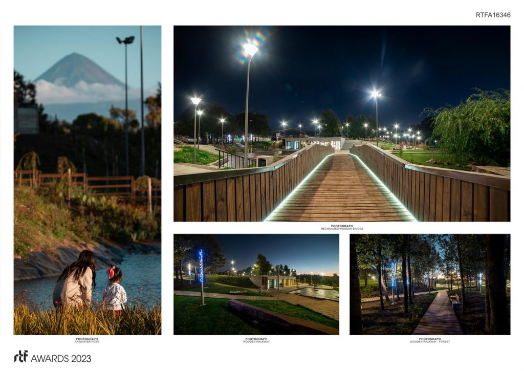
©Ignacia Astaburuaga
In order to promote the uses that are proposed in the park, a covered community facility is proposed that takes advantage of the differences in height found in the terrain and is located below the ground or urban hill, valuing the landscape above what is built. In addition, this condition favors the uses taking advantage of the roof as a stage that faces the civic esplanade where massive activities in the neighborhood are generated.
With respect to its materiality, the circulations and massive areas of greater traffic are proposed in stamped concrete, wood type without color in order to reduce their maintenance and wear and tear, which represent 5% of the surface of the park and the secondary circulations are made of wood. mechanically classified structural pine (MGP10) whose walkways, terraces and bridges were modeled and their pieces cut by means of machining in the plant, this to make the assembly efficient and productive, reduce the waste produced in a highly sensitive site, and to avoid unforeseen events that produce bad endings in sight.
- ©Ignacia Astaburuaga
- ©Ignacia Astaburuaga
- ©Ignacia Astaburuaga
